Tuesday, 21 November 2017

Bewerley Fish Pond and Glasshouses (4 miles)

Date : 21st November 2017.

Starting Point: Park in any of the car parks in Pateley Bridge.

Description: Easy, mostly level walk with a visit to Bewerley Fish Pond Woods.

Directions: From Pateley Bridge walk towards Greenhow and take the road on the left to Bewerley opposite the Royal Oak pub. Continue along the road. Look out for the entrance to Fish Pond Woods on your right. After visiting the woods continue along the road past Bewerley Park Riding Centre. After crossing a green metal bridge take the path on the left (s.p. Pateley Bridge 1 1/4 m).
Walk past the mill pond and continue on the riverside path back to Pateley Bridge.

  
Fish Pond Woods


Bewerley Fish Pond.


Bewerley Fish Pond.


The Monk's Steps.


The Icehouse. Built by local landowner John Yorke around 1800.


Inside the icehouse.


Mill pond at Glasshouses.


No idea what the purpose of this building is but it looked interesting !


Late Autumn leaves.


Weir on the River Nidd.


"Pillars Past" sculptures by Joseph Hayton representing three quintessential folk of the Dales - a miner, a farmer and a monk.


River Nidd


Wednesday, 25 January 2017

Arncliffe and Malham Tarn (10 miles)

Date: 25th January 2017

Description: Quite a strenuous walk but rewarding with fantastic views. Some steep uphill sections. Walking over fells, fields, farm tracks, with a bit of road walking at the end.

Starting Point: Park at the village green in the village of Arncliffe in Littondale.

The walk: Take the track by the side of The Falcon where a signpost points the way to Malham. Continue for a couple of hundred yards to follow the signposted path to Malham going off rightwards over a gated stile.
The path is obvious as it climbs and contours the fellside of Clowder ahead. The initial stretch is fairly steep until you reach a stile when the going gets much easier.
Continue on the path, crossing a few stiles and passing small cairns, with Cowside Beck far below.
Eventually the path crosses a stile to enter the National Trust's Malham Tarn Estate (signposted).
Continue on the obvious path. Shortly after crossing a stile Middle House, sheltered by a stand of trees, comes into view, together with a signpost to Darnbrook. Here you could cut the walk short by following the sign to Darnbrook but you will miss the delights of Malham Tarn.
The path becomes a vehicle track as it passes Middle House Farm. It leaves the wall to rise to a gate and stile. After crossing the stile, with Middle House Farm to your left, leave the main track and go straight down the slope (faint path) to discover a stile in the fence next to a telegraph pole.
Turn right down the access road. Walk down the farm road to a stand of trees. Cross the cattle grid and turn immediately right. Continue with the wall on your right to reach Malham Tarn.
Follow the fence round the edge of the trees to the main tarn track and turn right.
Walk along the main track to the cattle grid at the entrance to the wood. Don't cross the cattle grid but climb the hillside as the path veers to the right to reach a signpost for Middle House.
At the top of the hill the path leaves the fence on the left and continues midway between fences and telegraph poles on the right with Middle House once more in view.
Cross a stile next to a gate and turn diagonally left along a faint path up the hill to the gate you came through on the outward journey.
Go in the same line to the track and turn left over the stile to regain Middle House and the signpost to Darnbrook just beyond,then turn left to Darnbrook.
The path is obvious as it reaches a stile to leave the National Trust land.
You now pass an area of ancient limestone walls and enclosures, a surviving relic of the Iron Age.
Keep to the left of a jumbled limestone wall on the far side of the settlement. Follow the path down. At one point the path contours horizontally right before turning sharp left downhill beside the remains of a wall. Pass a cairn and soon bear left when a footbridge will materialise over Cowside Beck. Cross this and a stile and follow the meadow path to Darnbrook.
Pass through the farmyard and turn right up the road.The first 500 or 600 yards are steeply uphill but, after levelling out, the last mile is all downhill to Arncliffe.

The pub: The Falcon, Arncliffe. The Falcon is the original "Woolpack" in Emmerdale. After a strenuous walk I was ready for a pint of Timothy Taylor's Landlord and a delicious bowl of pork pie and baked beans (they'd run out of mushy peas and I was given the choice of garden peas or baked beans).


On the first uphill climb.


Looking back down to early morning mist over Arncliffe.

  
Looking down on the valley and Cowside Beck.


Entering the National Trust's Malham Tarn Estate.


High up on the fells toward Middle House.


Didn't like look of those horns, and neither did Pippa.


A short detour onto the limestone pavement.


The point where you could cut the walk short.


Middle House is where the monks had their grange, tending their vast flocks of sheep on Malham Moor. The house is mentioned in the poll tax rolls of 1377. The present buildings date from the 17th century and were inhabited until about 60 years ago. They were partly renovated about 25 years ago by a Manpower Services Commission youth scheme, but the project appears to have run out of money before completion. Middle House now stands forlorn and deserted.


Middle House Farm.


Limestone scenery as the sun shone in the late morning.


More limestone scenery.

  
Malham Tarn is the biggest natural lake in the Dales and covers 153 acres, but for all its size it is never more than 14 or 15 feet deep. It was much valued for its fishing by the monks of Fountains Abbey.


Looking back down to Malham Tarn.


My faithful walking companion, Pippa.


Ancient limestone walls and enclosures. When the Roman legions advanced through the north, the British tribes , after their defeat, took to the high ground and survived by keeping out of the way of the intruders.


Looking down on the approach to Darnbrook.


Footbridge and stile over Cowside Beck.


The Falcon, Arncliffe.


Sunday, 27 November 2016

Gargrave and the Pennine Way (8 miles)

Date: 27th November 2016

Starting point: Car park on North Street, Gargrave.

Description: Nice walk from Gargrave to Airton, mostly on country lanes. Return to Gargrave through fields following The Pennine Way.

The walk: From the car park turn right and go over the canal road bridge. When the lane swings right go straight up the "no through road" with the high wall of Gargrave House on your left.
Follow the country lane past Gargrave House Gardens . The lane past Gargrave House is single track, traffic free and after a while is unmade.
Continue along the track to descend to Bell Busk. Cross a bridge with a datestone 1837 and then another bridge and here turn along the road into the village (do not turn right up the road signposted Airton and Malham).
After about 300 yards turn right down the signposted bridleway. Cross a stream by a bridge and then, on passing a barn on your left, keep along the fence on your left, ignoring the vehicle track on the right. Follow the fence through a gate and bear rightwards along a good path. Go through a gate and on past a barn to follow another walled track, Kirk Syke Lane.
The track becomes tarred and leads into Airton. At the T junction turn right into the village..
Cross the main road and walk down past the village green, descending the lane to the infant River Aire.
Continue down the hill, cross the bridge and then turn right along the signposted Pennine Way riverside path. Follow the path to a footbridge. After crossing turn left, then right up the hillside with the wall on your right.
From here follow the Pennine way signposts all the way back to emerge in the lane of the outward journey. Turn left to Gargrave, the finish.

The pub: The Masons Arms. A short walk through the centre of Gargrave. Cross the main road and then go over the river bridge onto Church St. to reach the pub. I enjoyed a refreshing pint of Timothy Taylor's Landlord.


Pointing the way near the start.


Canal locks at Gargrave.


On the outward journey.


Looking towards Airton.


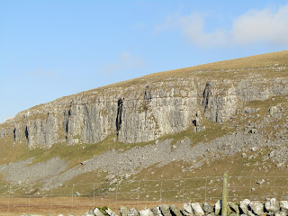
Haw Crag.


Mark House Lane


Date stone on bridge at Bell Busk.


Bridge over stream at Bell Busk.


Kirk Syke Lane


Ellis House  at Airton built by William and Alice Ellis.


Sharphaw and Roughhaw.

Woodland on the Pennine Way.


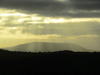
Pendle Hill, late afternoon.

Masons Arms, Gargrave.


Sunday, 23 October 2016

Burnsall, Linton and Thorpe ( 6 miles )

Date: 19th October 2016

Starting point: Car park in Burnsall.

Description: Easy to follow. Mostly level walking on riverside.

The walk: From the car park, cross the road and take the riverside path to the right of the Red Lion. Follow this path all the way to the suspension bridge. Cross the bridge and continue on the opposite bank of the river to the stepping stones.
If the river level is high or, like me, you're not comfortable with stepping stones, then go right through the gate , past the cottages and fish farm to reach a signposted path going left. Walk through the fields to the falls, turn left over the footbridge and then left down the lane to the church.
Walk out of the churchyard over a high stone - step stile leading into the lane to Linton Falls ( retracing your steps if you came by way of the falls.
Walk up the lane to the first cottages on your left and turn up a walled track at the side of the last cottage. ( signpost Stickhaw and B6160 ). Enter a field and aim for the left hand side of a barn, where you will find a stile in the wall. Go past the barn and over the brow and then diagonally right across the meadow to a stile. Cross two thin fields to emerge into the road. Turn right for about twenty paces, then left into a bridleway to Thorpe Lane.
Go half left up a field past a telegraph post and follow the direction of the signpost to a gate giving access to a walled footpath which leads to Thorpe Lane. Turn left on the lane. At the end of the lane turn right into Thorpe.
Swing left up the lane in front of the village green,past a fine Georgian house and climb the hill out of the hamlet. After a couple of hundred yards, look out for a walled track on the right signposted Burnsall. Follow the track, with no diversions, downhill until it ends. Take the gate on the right and continue down the slope.
The path is obvious and waymarked as it crosses the fields by a series of gap stiles. It eventually crosses  the unsurfaced Badger Lane to continue in the same line over the brow of the hill when the tower of Burnsall church comes into view. Follow the route downhill to the end of the walk.

The pub: Red Lion Hotel, Burnsall. Good selection of cask ales. I chose a deep amber seasonal ale, Theakston's Infallible. Will be looking out for this one again.


Loup Scar

Suspesion Bridge built in 1885

Stepping Stones. I didn't cross them !

Linton Falls

Linton Church

Thorpe

Burnsall Bridge

Red Lion Hotel, Burnsall