Sunday, 27 November 2016

Gargrave and the Pennine Way (8 miles)

Date: 27th November 2016

Starting point: Car park on North Street, Gargrave.

Description: Nice walk from Gargrave to Airton, mostly on country lanes. Return to Gargrave through fields following The Pennine Way.

The walk: From the car park turn right and go over the canal road bridge. When the lane swings right go straight up the "no through road" with the high wall of Gargrave House on your left.
Follow the country lane past Gargrave House Gardens . The lane past Gargrave House is single track, traffic free and after a while is unmade.
Continue along the track to descend to Bell Busk. Cross a bridge with a datestone 1837 and then another bridge and here turn along the road into the village (do not turn right up the road signposted Airton and Malham).
After about 300 yards turn right down the signposted bridleway. Cross a stream by a bridge and then, on passing a barn on your left, keep along the fence on your left, ignoring the vehicle track on the right. Follow the fence through a gate and bear rightwards along a good path. Go through a gate and on past a barn to follow another walled track, Kirk Syke Lane.
The track becomes tarred and leads into Airton. At the T junction turn right into the village..
Cross the main road and walk down past the village green, descending the lane to the infant River Aire.
Continue down the hill, cross the bridge and then turn right along the signposted Pennine Way riverside path. Follow the path to a footbridge. After crossing turn left, then right up the hillside with the wall on your right.
From here follow the Pennine way signposts all the way back to emerge in the lane of the outward journey. Turn left to Gargrave, the finish.

The pub: The Masons Arms. A short walk through the centre of Gargrave. Cross the main road and then go over the river bridge onto Church St. to reach the pub. I enjoyed a refreshing pint of Timothy Taylor's Landlord.


Pointing the way near the start.


Canal locks at Gargrave.


On the outward journey.


Looking towards Airton.


Haw Crag.


Mark House Lane


Date stone on bridge at Bell Busk.


Bridge over stream at Bell Busk.


Kirk Syke Lane


Ellis House  at Airton built by William and Alice Ellis.


Sharphaw and Roughhaw.

Woodland on the Pennine Way.


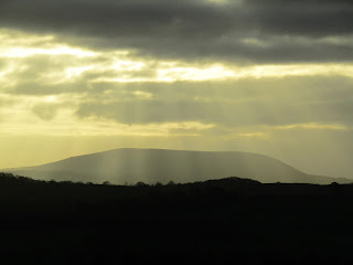
Pendle Hill, late afternoon.

Masons Arms, Gargrave.


Sunday, 23 October 2016

Burnsall, Linton and Thorpe ( 6 miles )

Date: 19th October 2016

Starting point: Car park in Burnsall.

Description: Easy to follow. Mostly level walking on riverside.

The walk: From the car park, cross the road and take the riverside path to the right of the Red Lion. Follow this path all the way to the suspension bridge. Cross the bridge and continue on the opposite bank of the river to the stepping stones.
If the river level is high or, like me, you're not comfortable with stepping stones, then go right through the gate , past the cottages and fish farm to reach a signposted path going left. Walk through the fields to the falls, turn left over the footbridge and then left down the lane to the church.
Walk out of the churchyard over a high stone - step stile leading into the lane to Linton Falls ( retracing your steps if you came by way of the falls.
Walk up the lane to the first cottages on your left and turn up a walled track at the side of the last cottage. ( signpost Stickhaw and B6160 ). Enter a field and aim for the left hand side of a barn, where you will find a stile in the wall. Go past the barn and over the brow and then diagonally right across the meadow to a stile. Cross two thin fields to emerge into the road. Turn right for about twenty paces, then left into a bridleway to Thorpe Lane.
Go half left up a field past a telegraph post and follow the direction of the signpost to a gate giving access to a walled footpath which leads to Thorpe Lane. Turn left on the lane. At the end of the lane turn right into Thorpe.
Swing left up the lane in front of the village green,past a fine Georgian house and climb the hill out of the hamlet. After a couple of hundred yards, look out for a walled track on the right signposted Burnsall. Follow the track, with no diversions, downhill until it ends. Take the gate on the right and continue down the slope.
The path is obvious and waymarked as it crosses the fields by a series of gap stiles. It eventually crosses  the unsurfaced Badger Lane to continue in the same line over the brow of the hill when the tower of Burnsall church comes into view. Follow the route downhill to the end of the walk.

The pub: Red Lion Hotel, Burnsall. Good selection of cask ales. I chose a deep amber seasonal ale, Theakston's Infallible. Will be looking out for this one again.


Loup Scar

Suspesion Bridge built in 1885

Stepping Stones. I didn't cross them !

Linton Falls

Linton Church

Thorpe

Burnsall Bridge

Red Lion Hotel, Burnsall

Saturday, 22 October 2016

Embsay Crag and Reservoir ( 3 miles )

Date: 16th October 2016

Starting point: Car park at Embsay reservoir at the end of Pasture Lane.

Description: On a rare day off work together, the plan was for me and my wife Sandra to have lunch at The Elm Tree Inn and then have a stroll around the reservoir. My secret plan was to climb the crag and after some gentle persuasion, off we went. I can't take any credit for the photos as I left my camera behind. Sandra took these on her phone.

The walk: From the car park approach the reservoir and turn right along the water board road. Turn left through a gate at the end of the road and follow the path round to the left hand corner of the reservoir. Exit the path onto a lane, turn right and then, almost immediately right again, at the information board. Follow the lower of the two path as it rises past blue - topped marker posts. Take the path going to the left of the crag skirting round and upwards on a rocky track to the summit. Retrace your steps back to the start.

The pub: The Elm Tree Inn. Good choice of ales at the bar. I went for Charles Wells' Bombardier. Good food too.


The Elm Tree Inn

Crag and Reservoir

Information board

Embsay Crag

View from the summit

On top of the Crag


Tuesday, 11 October 2016

Kettlewell and Starbotton ( 5 or 7 miles )

Date: 9th October 2016

Starting point: Pay and display car park in Kettlewell.

Description: I've done this walk many times but never tire of it. The views are some of the best in the Yorkshire Dales. Easy to follow directions.

The walk: From the car park turn left into the village, over the bridge spanning the beck and turn right at the Bluebell Hotel up the Leyburn - Coverdale road. At the T junction, by the village store, turn left past the YHA and then turn right to enter a walled track. The track turns left with the wall and passes along a path through meadows all the way to Starbotton.
Just before the cluster of buildings that make up Starbotton, the path dips left a gate to emerge in the village. Here, I would recommend a stroll round the village and a rest break at the Fox and Hounds.
After taking refreshment, return to where you entered the village and take the walled track opposite down to the Wharfe. (signposted Kettlewell and Buckden).
Cross the river over the footbridge, carry straight on up the hill along a narrow path between walls. The path swings left, past a barn, to begin the climb through a wood. The climb is quite steep but you will be rewarded by the magnificent views when you emerge from the wood.
The track passes through several gates heading towards farm buildings. Just before reaching the farm buildings go right through a gap in the wall up to a gate. Go through the gate and then left between the buildings, then right with the wall on your left.
Now keep on by the wall with the spoil heaps of the old mine on your right and start the easy descent along the access track to Kettlewell.
To extend the walk, cross the road and take the path at the far side of the bridge (signposted Lover's Lane, Stepping Stones). Follow the path as far as the stepping stones, cross, and return on the opposte bank. Note: There are 2 ladder stiles, which may be difficult for dogs.

The pubs: The Fox and Hounds, Starbotton. Cosy Inn at the halfway point of the walk. Rebuilt in 1834. Fascinating display of jugs hanging from the ceiling. Two cask ales on the bar - Timothy Taylor's Landlord and my choice, a new one to me, Butter Tubs from The Yorkshire Dales Brewing Co. based in Askrigg, North Yorkshire.

The Racehorses Hotel, Kettlewell. Seated riverside terrace at the rear. Three Timothy Taylor's ales on the bar. I chose the very respectable Ram Tam.


Upper Wharfedale

One of many 17th century cottages clustered 
around Starbotton

Footbridge over the River Wharfe at Starbotton

Looking back at Starbotton with Buckden Pike
in the background

Looking down on the meandering River Wharfe

Stepping stones on the extension walk

The Fox and Hounds, Starbotton

Racehorses Hotel, Kettlewell

Tuesday, 4 October 2016

Pendleside Villages (9 miles)

Date: 2nd October 2016

Description: A walk that visits 4 of Pendleside's villages, starting at the picturesque village of Downham. Some road walking towards the end.

Starting point: Car park at Downham.

The walk: From the car park walk up the hill and turn right pat the Assheton Arms. This leads past cottages to a footpath. Turn left, pass through a pair of gates and ascend to the ridge. Over the ridge descend in the same direction to reach a stile onto the road. Turn right and walk along the road until you reach a farm track on the right, signposted "to the mill". Walk along the track onto a path passing the mill pond and stream on your left. Cross the stream at a wooden footbridge and turn right with the stream on your right. Keep ahead until you reach a stile in a hedge. After crossing this, ascend the slope to reach a second stile. From here a concessionary path will bring you to a farm drive below Stubs Wood. Turn left along the drive and then cross a stile on the right. Follow the path up the field and take a stone stile, to the left of the gate onto the road. Turn right to arrive in Rimington.
Walk along the main street and immediately past Cosgrove's, formerly the Black Bull, turn left along a footpath. It leads down to a gate and a ginnel. On meeting a track cross it to a stile and continue a gradual descent with the hedge on your left. After crossing Stankill Beck keep keep ahead until just before a stile. Turn left and follow the field boundary until a footbridge is reached. Cross this and follow the path as it crosses beneath a railway track. The path leads you onto a farm track and to a stile in a fence. Here, the signpost is somewhat misleading,pointing straight up the hill. Take a more diagonal line to a tree lined boundary. This will bring you to a metal gate with a marker pointing left diagonally upwards. After a stile in a fence turn right at the far corner of a strip of woodland.Keep ahead past the wood to arrive at a complex of of properties around Sawley Grange.Waymark signs will lead you through these and onto the A59 road. Cross the road to a stile next to a gate and begin to drop with a hedge on your left. After the remnants of a farm building , bear left to reach a stile in the far corner of the field. Cross this and then turn left over a stile in the wall. Keep ahead with the farm complex of Dockber on your right. At the end of the wall take the footpath on the right leading up to Dockber. Turn left on the main track and follow it until you reach the edge of Sawley. Walk through the village passing Sawley Abbey on your left to reach the A59. Turn right and follow the cycle path to Chatburn. To visit Chatburn continue past the church and then return to the church and take the road uphill directly across the road which will lead you back to Downham.

The pubs: A choice of 2 pubs on the walk.

 Spread Eagle, Sawley. Nice pub but don't expect to get served quickly if they are busy serving food. A jazz trio were playing when I visited (Sunday afternoon). 4 local cask ales on the bar including my choice, Bowland Brewery's Sawley Duck.

Assheton Arms, Downham.4 cask ales on the bar. I opted for Theakston's Lightfoot.


Downham

Pendle Hill

River Ribble at Sawley

Spread Eagle at Sawley

Sawley Abbey

Assheton Arms, Downham

Monday, 26 September 2016

Barley and Newchurch in Pendle (4 miles)

Date: 25th September 2016

Description: A short walk from Barley along Pendle Water, then up to Newchurch in Pendle passing Clarion House. Fantastic views of Pendle Hill along the way.

Starting point: Large car park at Barley picnic site.

The walk: Walk to the far side of the car park in the opposite direction to the toilets and join the track signposted with the distinctive witch waymarkers of the Pendle Way footpath. This leads between cottages and goes through a gate following a track with the stream of Pendle Water on the right. Continue straight ahead along this track and when the houses at White Hough are reached on the left just continue straight ahead until the access road bends sharp right over the stream.
Leave the lane here as waymarked footpaths point to paths straight ahead on either side of the stream. Cross the stream and join the path following the right hand bank of the stream. This is a pleasant stream side path passing a farm on the right. It soon joins a lane at a gap in white railings. Turn right along the lane back to a crossroads. Join the lane almost opposite, Jinny Lane, which soon leads to the Clarion House on the right hand side.
From the Clarion House simply go back and turn right along Jinny Lane and follow this quiet narrow road into Newchurch. The lane climbs steeply as you reach the village with a conifer plantation to your right. At the road junction turn left if you want to visit the village church but to continue the walk turn right uphill passing the Witches Galore gift shop on the left.
Continue uphill along the lane and on the brow of the hill turn sharp right along the tarmac farm access road signed as a footpath. Ignore the path forking right off this leading alongside a woodland but continue along the access road to the farm buildings.Pass the first farm and stables on the left and as you approach the second set of buildings take a path on the left leading downhill alongside an electrified fence. This path emerges onto a stony track. Turn left along the track and it drops downhill to a lane. Turn right along this past Barley village hall on the left. Turn right at the lane junction, crossing the stream again, to return to the car park on the left.

The pub: The Pendle Inn. Dog friendly pub with 6 locally sourced cask ales on the bar, including my choice Moorhouse's Pride of Pendle.


Waterfall on Pendle Water

Clarion House, established in 1912 by the Nelson branch 
of the Independent Labour Party. Generations of walkers and
cyclists have stopped here for a brew and thanks to volunteers
you can still stop here for refreshments on a Sunday.


Looking back down Jinny Lane

Pendle Hill in the mist and rain

The Pendle Inn

Sunday, 18 September 2016

Barden Bridge, Bolton Abbey and The Strid. ( 7 or 8 miles )

Date: 16th September 2016

Starting point: Small car park at Barden Bridge.

Description: An easy to follow walk alongside the River Wharfe.

The walk: Leave the car park and go through the hand gate onto the path. Follow this path for about 3 miles. Don't cross the bridge to the pavilion.
After crossing a stream by either a ford or footbridge walk up a lane for a few yards and go through the gate on the right. On meeting a choice of 2 footpaths take the one on your left rising.
Follow the path to descend to the bridge at Bolton Abbey. Cross the river by either the bridge or stepping stones.
To visit the pub take the path up to the right of the ruins to the road. Turn left and follow the road for about half a mile to the Devonshire Arms. Return along the road and follow the signs for the ruins, passing the tea rooms.
Take the path down to the bridge and cross. This time take the lower path which eventually reaches the path you previously came along. Continue until you cross the bridge to the pavilion.
Turn right and follow the river upstream all the way back to Barden Bridge, passing The Strid on the way, to the finish.

The pub: The Devonshire Arms. More of  a bistro but a nice seating area at the back. Black Sheep Bitter and two Copper Dragon ales on the bar. I went for the Black Sheep.

 Barden Bridge. The current bridge was built in 
1659, to replace an earlier crossing that served 
nearby Barden Tower.
 Barden Aqueduct, constructed in the 1850s as
part of a complex engineering project to supply 
water to the rapidly expanding city of Bradford.
 A good resting place on the way out to Bolton Abbey.
 The ruins of Bolton Abbey
The Devonshire Arms
The Strid
The River Wharfe


Bridge and Stepping Stones at Bolton Abbey.